Kirjeldus
The application was tested on Microsoft LUMIA 550/Windows 10 This continues the application IoT_LocationDevice_R2/LocationHelp/LocationHelp2/LocationNear2points This is necessary for interventions in special cases of earthquakes , accidents , transport problems......,
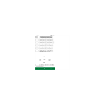
You can determine altitude of the places from the map by clicking. So, you know if the tsunami is dangerous , if the height of the produced wave is higher than the altitude of the place where you stand , you will try to move in another higher place.... This model will be for mark-cross If you choose this app you have only max.20minuts (700m,running) to save. Therefore, summary of the operation: 1. First Location 2.After Map //Is important order by cross:1=origin; 2=UP; 3=LEFT; 4=RIGHT; 5=DOWN; (This model is based on the research in the cross) other BUG IN ,BUG OUT! and in 15-30 minutes you can run max.600m 3.In Map click in my location where I am (tap = 1) 4.In Map click in other place from the cross UP (tap = 2) 5.In Map click in other place from the cross LEFT (tap = 3) 6.In Map click in other place from the cross RIGHT (tap=4) 7.In Map click in other place from the cross DOWN (tap = 5) 8. After two click on map appear message with max position 9.In STREET we can see value of the all positions and diagram Click pe MAX and appear the distance from origin to maxim position in km 10.We can repeat phases 1-9 for other cross
Teistele meeldivad
Arvustused
artiklid
- 1
Windowsi skanner
 Tasuta
 - 2
HyperX NGENUITY
Tasuta - 3
NVIDIA Control Panel
Tasuta - 4
OP Auto Clicker
Tasuta - 5
Raw pildilaiend
Tasuta - 6
Apple Devices
Tasuta
- 1
Arsh Player
Tasuta - 2
Linn Kazoo
Tasuta - 3
Scanner One
Tasuta - 4
Glassbrick - Screen Magnifier
Tasuta - 5
Simple Screen Ruler
Tasuta - 6
MHT Viewer
Tasuta
- 1
Windowsi skanner
Tasuta - 2
HyperX NGENUITY
Tasuta - 3
NVIDIA Control Panel
Tasuta - 4
OP Auto Clicker
Tasuta - 5
Raw pildilaiend
Tasuta - 6
Apple Devices
Tasuta
- 1
Roblox
Tasuta - 2
Minecraft Launcher
Tasuta - 3
Roger That: Merge Adventure Games!
Tasuta - 4
Hidden City: Hidden Object Adventure
Tasuta - 5
Sherlock: Detective Hidden Object & Match 3 Game
Tasuta - 6
Angry Birds Friends
Tasuta