Kirjeldus
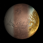
GlobeViewer Mars is an interactive and three-dimensional globe of the entire surface of Mars. The 3D global map shows all official designations for various surface features. If you are interested in a specific region, an even higher resolution local 3D map view can be loaded for a closer look at the craters, mountains and other formations. In addition, a mission log of all Mars missions since 1960 has been included.
Since version 0.4 we show the landing region of NASA's Mars2020 mission. The extra high-resolution landing site map was generated using HiRISE data from the Mars Global Observer. Here you can see the rover's surroundings in Jezero Crater. In addition, you can enhance the heights in the 3D map to get an even better impression of the height gradients. The map shows the movements of the Perseverance rover and the Ingenuity helicopter, so you can follow the current mission progress on this map.
Since version 0.7 there are now impressive detailed views created from the photos of Percy and Ingy using photogrammetry. Look at the stones and rock formations as if you are right there on Mars! These great detailed views have been integrated into the M2020 history list.
From version 0.8 we support 12 additional languages, so the app is now available in a total of 18 languages.
We hope you enjoy exploring the red planet virtually.


